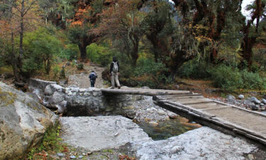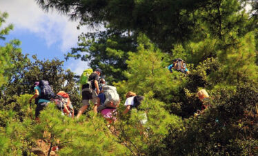
TREK THE WILDEST, MOST BREATHTAKING ABSOLUTE OFF-THE-BEATEN SNOWMAN TREK IN BHUTAN. The Snowman Trek is our most challenging trek in Bhutan and ranks amongst the very finest anywhere in the Himalayas. The ultimate high-level traverse through the Bhutan Himalayas, from Shana, through Laya, to Lunana. The trek lies within the protected areas of Jigme Dorji National Park.
The Trek is the longest hiking trail in Bhutan, and it extends from Laya to the high Bhutanese Himalayas, covering the northern part of the Kingdom. The yak herders of the country created it. It is one of the hardest trekking trails due to the harsh weather, duration, and altitude in the world, and most trekkers do not complete the route.
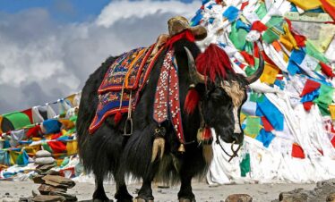
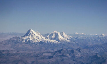
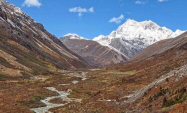
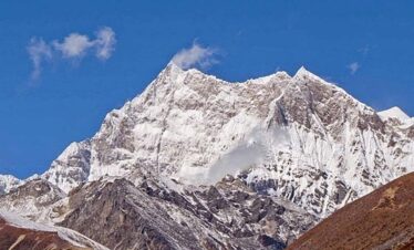
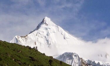
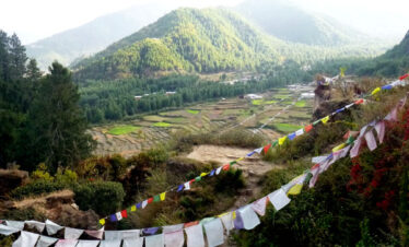
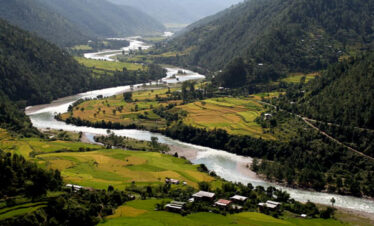
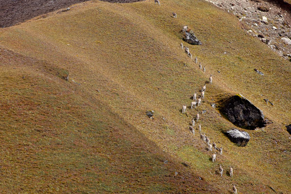
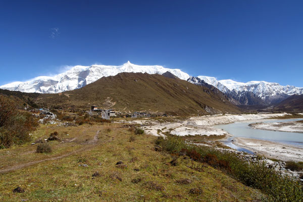
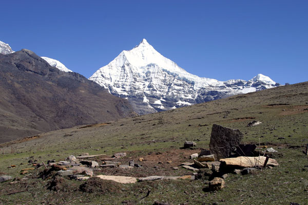
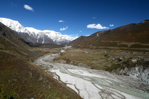
The route begins in Lunana, higher up to Gangkar Puensum and ends in Sephu in Wangdi. It takes you through remote villages, lakes, and eleven mountain passes. It provides you with picturesque views of some of the highest mountains of the Kingdom, like Jomolhari, Jichu Drake, Gangkar Puensum, Masangang, Tiger Mountain, etc. It was also reported that the snow leopards could be found on the way, although there has been no report of danger.
The Snowman Trek Quick Overview
- Trip Name: Snowman Trek.
- Trip Duration: 26 Days
- Max.Altitude: 5230m/17,259ft at Gophula Pass.
- Best Season: September to November
- Meal: Full board (breakfast, lunch, and dinner)
- Accommodation: Government-approved 3-star and Above
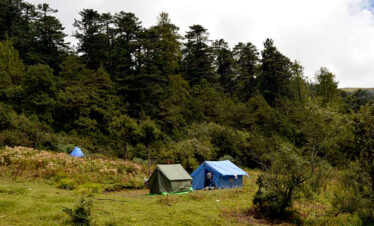
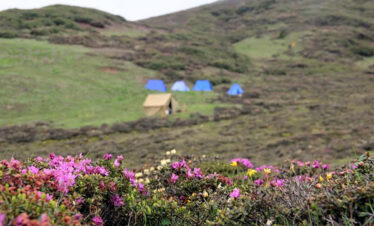
- Camping Equipment: All imported tents and camping equipment
- Transportation: Private car, van, or bus (Depends on group size)
- Porter/Pony: All Inclusive
- Trip Type: Private Tour & minimum 2 in the Group.
- The total distance of the Snowman Trek is 348KM
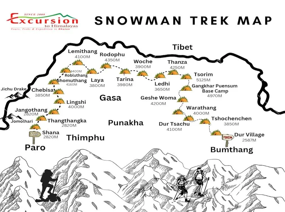
The Snowman Trek Itinerary Overview
- Day 1 Arrival Paro
- Day 2 Paro City Tour
- Day 3 Trek begins from Shana
- Day 4 Thangthangka to Jangothang. Distance 15KM | Walking Time 6/7 Hours | Camping Altitude 4115M.
- Day 5: Jangothang Acclimatisation. Camping Altitude 4115M.
- Day 6: Jangothang to Lingshi. Distance 16KM | Walking Time 6/7 Hours| Camping Altitude 4150M.
- Day 7: Lingshi to Chebisa. Distance 10KM | Walking Time 5/6 Hours | Camping Altitude 3850M.
- Day 8: Bhutan Snowman Trek from Chebisa to Shomuthang. Distance 17KM | Walking Time 7/8 Hours | Campong Altitude 4160M | Maximum Alt 4500M.
- Day 9: Shomuthang to Robluthang. Distance 18KM | Walking time 8/9 Hours | Camping Altitude 4400M | Maximum Altitude 4600M.
- Day 10: Robluthang to Lemithang. Distance 19Km | Walking Time 6/7 Hours | Camping Altitude 4100 m | Maximum Altitude 4160M.
- Day 11: Lemithang to Laya. Distance 10KM | Walking Time 5/6 Hours | Camping Altitude 3800M | Maximum Altitude 3800M.
- Day 12: Leisure time at Laya Village. Camping Altitude 3800M.
- Day 13: Laya to Rodophu. Distance 14.5 KM | Walking time 8/9 Hours | Camping Altitude 4350M | Maximum Altitude 4350M.
- Day 14: Rhodophu to Tarina | Distance: 36Km | Walking time: 10 to 11 Hours | Max Altitude: 5080m | Ascent: 725m Descent: 1200m | Camping Altitude: 3980m
- Day 15:Tarina to Woche. Distance 17KM | Walking time 6/7 Hours | Camping Altitude 3800M | Max Altitude 3910M
- Day 16: Woche to Lhedi. Distance 17KM | Walking time 6/7 Hours | Camping Altitude 3650M. Max Altitude 3700M.
- Day 17:Lhedi to Thanza. Distance 17 km, Walking Time 7/8 Hours | Camping Altitude 4000M.
- Day 18:Thanza to Danji. Distance 8KM | Walking time 3/4 Hours | Camping Altitude 4230M.
- Day 19:Danji to Tshochena. Distance 12KM | Walking Time 6 Hours | Camping Altitude 4925M | Max Altitude 4970M
- Day 20:Tshochena to Jichudramo. Distance 12KM | Walking Time 6 Hours | Maximum Altitude 4970M.
- Day 21:Jichudramo to Chukarpo. Distance 12KM | Walking Time 6 Hours | Maximum Altitude 4970M.
- Day 22:Chukarpo to Thampe Chho. Distance 12KM | Walking Time 6 Hours | Maximum Altitude 4970M.
- Day 23:Thampe Cho to Maurothang. Distance 12KM | Walking time 6 Hours | Camping Altitude 4900M | Maximum Altitude 4970M.
- Day 24:Maurothang to Sephu. Distance 12KM | Walking Time 6 Hours | Maximum Altitude 4970.
- Day 25:Sephu to Roadpoint and to Thimphu | Distance 136.6km | Driving time 3hrs 43mins | Altitude 2400m
- Day 26:Thimphu to Paro and See Off | Distance 49.9km | Driving time 1hr 18mins | Altitude 2300M.
The Snowman Trek Cost
- Solo Trekker Cost USD 18840.00
- 2 Pax Group Cost: USD 14500 Per Person
- 3 to 4 Pax Group Cost: USD 12440.00 Per Person
Note: All our trek costs include daily SDF, one-time visa fees, Camping equipment, Guide, meals, and Porter. There is no hidden cost. If you plan to visit Bhutan from the USA, check travel information here.
The Snowman Trek Overview
The Snowman Trek is an extended and demanding trek that traverses the high altitudes of the Bhutanese Himalayas, reaching elevations of over 5,000 meters (16,400 feet). It typically takes around 25-30 days to complete, covering a distance of approximately 200 miles (330 kilometres). The trek starts in Paro and ends in Bumthang, crossing through some of the most remote and pristine landscapes in the country.
Snowman Trek Difficulty
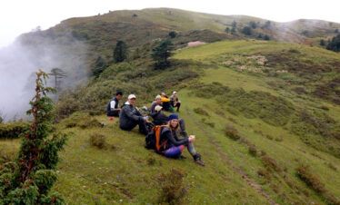
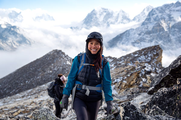
People know the Snowman Trek for its difficulty due to its high altitude, challenging terrain, and unpredictable weather conditions. Trekkers need to be physically fit, experienced in high-altitude trekking, and prepared for long and strenuous days of walking. The trail involves steep ascents and descents, crossing several mountain passes, and camping in remote areas without access to modern facilities. We have prepared the best way to prepare for the snowman trek.
Altitude and Acclimatization
Due to the high altitude, acclimatization is crucial during the Snowman Trek. Trekkers usually spend a few days in Paro and Thimphu to acclimatize before starting any trekking Tour in Bhutan. Additionally, the trek is designed to gradually gain altitude, allowing trekkers to adapt to the thinning air. It’s essential to follow a slow and steady pace, drink plenty of water, and listen to your body to prevent altitude sickness.
Permits and Guide for Snowman Trek
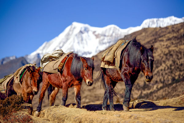
The Snowman Trek requires a special trekking permit from the Bhutanese government, and you must travel with a licensed tour operator. The operator will arrange for experienced guides, cooks, and a support team to accompany you throughout the trek. They will also take care of logistics, including food, camping equipment, and yaks for carrying supplies.
The Best Time to Trek Snowman
The best time to trek Snowman is not Spring season as many Bhutan Tour operator recommends. Since spring follows the peak winter season in Bhutan, many passes during the Snowman Trek remain closed and inaccessible. Heavy snow still covers the highest passes like Gangla Karchung (5100M). Little rain on the plain with heavy snowfall in the mountains. The pass will only be accessible by early June when the monsoon rain begins. Again this will have a bad experience for Trekkers. Therefore the best season for Trek Snowman is Fall or Autumn Season starting from September to December. The weather is safe and hardly any snow on the Mountains. For other Trekking tours, you can check the best time to trek in Bhutan in detail.
Similar Trekking in Bhutan
25 Days Snowman Trek Highlight
- Challenge yourself to one of the hardest Trek in the World.
- Visit the tribal village of Laya.
- Camp at the highest Mountains of Bhutan.
- Enjoy watching the wildlife of Bhutan as the trek falls on protected areas.
- Watch wildflowers and blue poppy(national flower of Bhutan).
- Discover the highest mountains and crystal clear lakes of Bhutan.
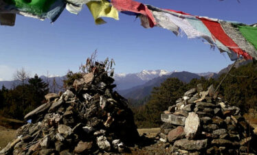
- Hoist the prayer flag on the highest mountain pass of Bhutan.
- Cross highest 11 passes during the Snowman trek in Bhutan.
- Challenge yourself on one of the longest 220 miles trekking in Bhutan Experience the ancient tradition and culture of Bhutan.
- Explore the largest Lake of Bhutan in Lunana.